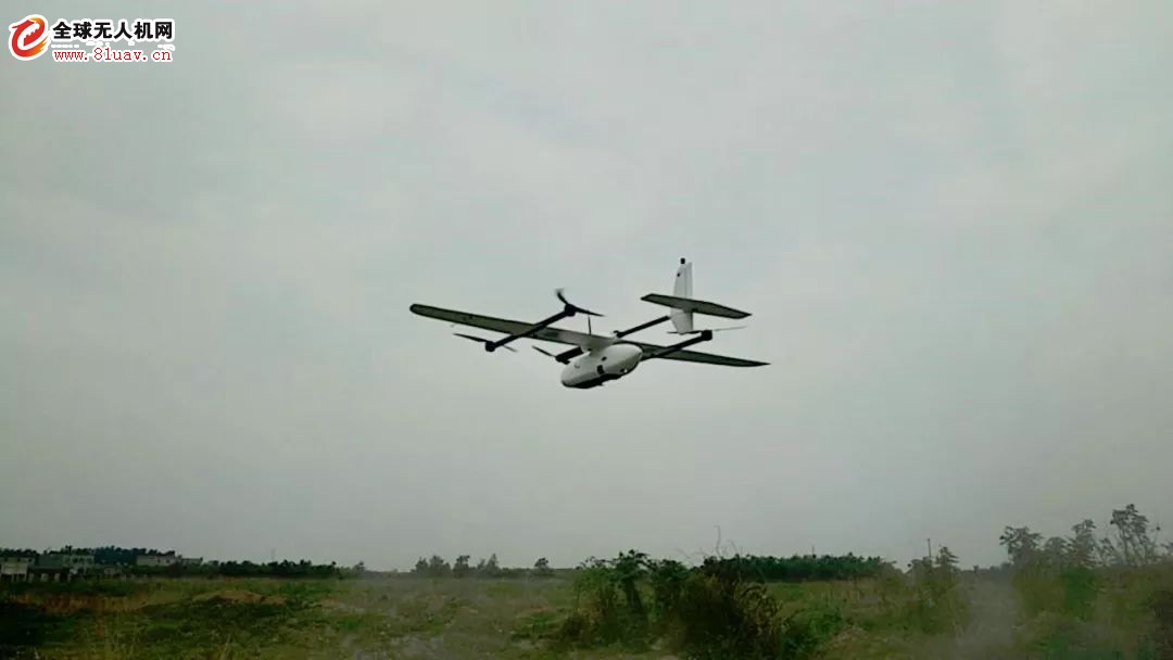
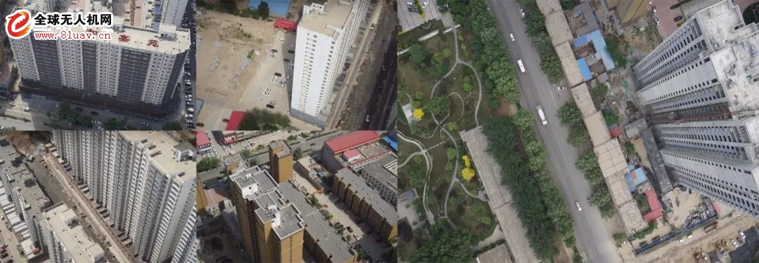
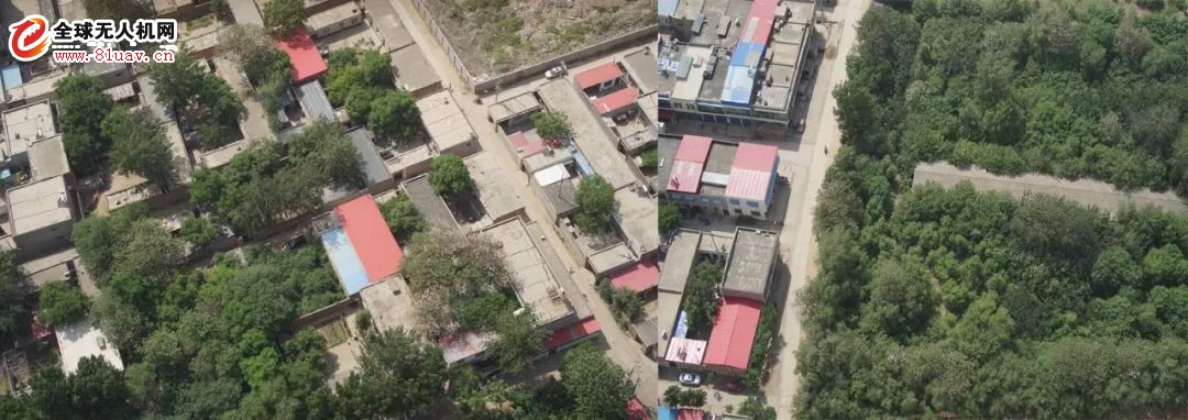
At this year's Dapeng Industry Application Summit, the academic report on the development and application of tilted photogrammetry technology has received great attention from aerial survey users. At the Dapeng Industry Summit in various places, Product Manager has analyzed the industrial application of the Dapeng series of tilting photography systems. Based on Dapeng UAV's tilting real-life model, GIS data collection has been widely used in basic surveying and mapping, real estate confirmation, rural housing sites, and old city renovation, etc., with its efficient and convenient, low-time work hours, and rich results. The advantages have won everyone's attention. The case we shared today is the application of CW-10 Dapeng in digital city stereo mapping. Today, I shared a three-dimensional modeling and stereoscopic pattern of a CW-10+ five-prong camera in a unit in Anguo City, Hebei Province. In order to better rely on the city's basic geographic information and related information database, and establish a unified and authoritative geospatial information public platform of the city, the data obtained by this flight plan is to use the 3D mapping software to produce 1:500DLG according to the aerial survey standard, and carry out the technical route. Verification to meet the 1:500 naked eye mapping needs in digital cities. This operation uses CW-10 for original image acquisition, and uses differential GPS to acquire image orientation elements. The measurement area is 1.6 square kilometers and the actual flight area is 3 square kilometers. The total voyage is 123km, a total of 2 flights, the heading and side overlap rate is 80%, 24 image control points are laid, and the ground resolution is 3cm. The result of this tilt photography modeling is completed by the CW-10 equipped with a total of 120 million five-pixel camera. Is there a small surprise? The mission area includes densely populated areas, high-rise buildings, roads, and vegetation coverage areas. Details of the specific results are as follows: High-rise area Dense area Vegetation coverage area As you can see, the precision of the densely populated areas and high-rise areas of the CW-10 equipped with the five-pronged camera is very high, and the texture of the building is very clear and the lines are straight. At the same time, the 3D real-world modeling results can be used to lock the height, quantity and number of houses, and then combine the spatial and temporal remote sensing image data to analyze the house age and floor changes, and greatly improve the mastery of information on the building conditions in the jurisdiction. The CW-10 is equipped with a five-pronged camera to complete the data acquisition of 3D modeling and stereo mapping, which is a revolution in small-area tilt photography. Whether it's voyage, flight efficiency, or data effects, even on large aircraft platforms such as the CW-20 and CW-30, the CW-10 tilt camera system still meets everyone's desire for efficiency and data accuracy. Imagine that if a small fixed-wing UAV such as the CW-10 is equipped with two cameras, the user will spend a lot of time on the flight, and the well-shaped route will not only more than double the range, but also reduce the operating efficiency instantly. The final modeling effect may be affected by excessive light changes due to long flight times. The two-six/three-six-camera flight's well-shaped route VS. Five-six-camera flight S-shaped route, the efficiency is high. The CW-10 is equipped with a five-prong camera. It can cover all the outer surfaces of the object with only one S-shaped route. The first flight can obtain both complete data of tilt and orthophoto. The working efficiency is high and the image quality of the camera is guaranteed. The 3D effect is good, and the acquired data is also very useful for basic mapping, 3D urban modeling and stereo mapping, which can better promote the integration, sharing and full utilization of information resources, and accelerate the process of urban informationization. Liquid Crystal Display For Home Appliances Liquid Crystal Display For Home Appliances,High Resolution Portable Lcd Display,Refrigerator Lcd Liquid Crystal Display,Response Fast Remote Lcd Monitor Dongguan Yijia Optoelectronics Co., Ltd. , https://www.everbestlcdlcm.com


